
Navigating the world around us has become significantly easier with the advent of technology, especially with the use of GPS (Global Positioning System) and maps. These tools have revolutionized the way we travel, explore new places, and find our way to destinations. Whether you’re driving, walking, or hiking, knowing how to use GPS and maps effectively is a fundamental skill. In this article, we’ll delve into the basics of using GPS and maps, their functionalities, and how to make the most of them.
What is GPS?
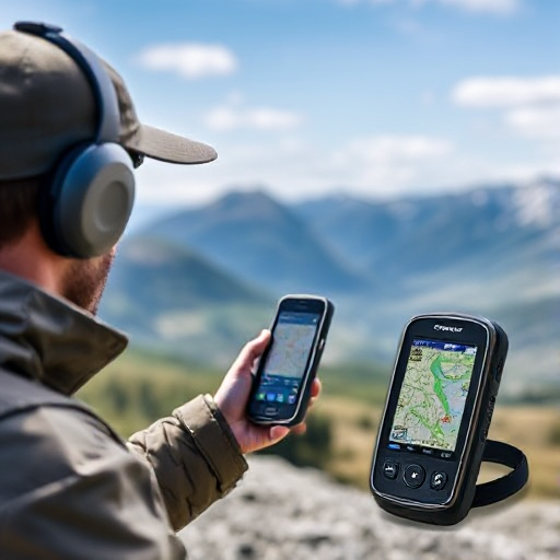
GPS, or the Global Positioning System, is a satellite-based navigation system that helps users determine their precise location anywhere on Earth. The system consists of a network of satellites orbiting the planet, ground stations, and GPS receivers (devices used by people to access GPS data). GPS works by triangulating signals from multiple satellites to pinpoint the user’s location.
A GPS receiver typically displays this information in the form of coordinates (latitude and longitude) and can also provide real-time directions to specific locations, traffic information, and estimated travel times. GPS has become integral to many everyday activities, including driving, hiking, flying, and even finding nearby restaurants or gas stations.
The Basics of Reading a Map
Maps, both physical and digital, serve as a crucial tool for navigation. They represent geographical locations and routes, and while GPS is often associated with digital maps, understanding how to read traditional paper maps is also important for a more comprehensive navigation skill set.
Here’s how to read and use a map effectively:
- Understand the Legend (Key): A map legend or key provides important information about what the symbols on the map represent. For example, roads, rivers, parks, airports, and other landmarks are all represented by specific symbols.
- Read the Scale: The scale shows the relationship between a distance on the map and the actual distance on the ground. For example, 1 inch on the map could represent 1 mile in reality. Knowing how to read the scale helps in estimating distances and planning your journey.
- Identify Directions: Maps typically include a compass rose or arrows indicating the cardinal directions (north, south, east, west). Understanding which direction is which on the map helps orient you in the real world.
- Locate Landmarks: By using the map’s features and symbols, you can identify your location or plan your route by looking for landmarks such as roads, rivers, and mountains.
- Contour Lines and Elevation: Topographic maps use contour lines to represent elevation. These lines help you understand the terrain’s shape and the steepness of hills and valleys.
How GPS Works
GPS technology is based on signals transmitted by a network of satellites in orbit around Earth. Here’s a simplified overview of how GPS works:
- Satellite Signals: GPS satellites send signals that contain the satellite’s location and the exact time the signal was transmitted. The GPS receiver receives signals from at least three or more satellites.
- Triangulation: Using the time it takes for the signal to reach the receiver, the GPS system calculates how far away each satellite is from the receiver. By measuring the distances from multiple satellites, the GPS receiver can pinpoint your location.
- Accuracy: GPS technology can offer varying degrees of accuracy. Consumer GPS devices typically offer an accuracy of about 10 meters, while advanced GPS systems can achieve accuracy within a meter or even a few centimeters.
- Mapping and Navigation: Once your position is determined, GPS systems can plot your location on a digital map. They can then provide turn-by-turn directions or suggest alternate routes if traffic or road conditions change.
Using GPS for Navigation
In modern times, GPS is most commonly associated with navigation apps and devices. Here’s how to effectively use GPS for navigation:
- Set Your Destination: In most GPS navigation systems (like Google Maps, Apple Maps, or specialized devices), you begin by entering the address or name of the destination. Some GPS systems allow voice commands or integration with other apps to make this process even simpler.
- Follow Directions: GPS navigation systems typically provide voice-guided turn-by-turn directions, making it easier for drivers or pedestrians to follow the route without having to constantly look at their device. They also adjust in real-time to changes in the route, such as accidents or road closures.
- Use Points of Interest (POIs): Most GPS apps include a database of Points of Interest (POIs), such as restaurants, gas stations, or tourist attractions. You can search for these nearby your current location, and the GPS will give directions to the chosen POI.
- Traffic and Real-Time Updates: Many GPS systems also provide live traffic data, helping users avoid congested areas or delays by rerouting them to alternate paths.
- Offline Maps: In areas with limited internet access, some apps and devices allow you to download maps for offline use. This feature is particularly useful for hiking or traveling in remote locations where network signals might not be reliable.
Combining GPS with Maps
While GPS provides real-time location data and navigation, understanding and utilizing traditional maps can still play a critical role in many navigation scenarios. Here’s how the two tools complement each other:
- Plan Your Route with Maps: Before starting your journey, you can use a map to plan your route in detail, taking note of alternative routes, landmarks, or places of interest. Once you’ve planned your route, you can use GPS for turn-by-turn navigation.
- Backup Navigation Tool: Maps can serve as a backup if your GPS signal is weak or lost, which sometimes happens in remote areas or during heavy weather. Having a paper map as a backup is a good practice when traveling off the beaten path.
- Understand Terrain and Elevation: Maps can provide additional context that GPS might not give you, such as terrain types, elevation levels, and other geographical features. This is especially important for outdoor activities like hiking or biking.
Tips for Using GPS and Maps Effectively
- Ensure Your GPS Is Updated: GPS devices and apps are only as good as their data. Make sure your GPS software is regularly updated to ensure you have the most accurate maps and data for your routes.
- Be Mindful of Battery Life: GPS navigation can drain your battery, especially if you’re using a smartphone. Carry a power bank or extra charging cables to avoid running out of battery during your journey.
- Know Your Surroundings: Even with GPS, it’s important to remain aware of your surroundings. Don’t rely solely on the GPS system; use it in conjunction with your understanding of the area to ensure you’re always on track.
- Use Offline Maps for Remote Areas: If you’re traveling to an area with limited cellular coverage, download maps in advance. This way, you’ll still be able to navigate even without an active internet connection.
- Plan for Detours and Alternative Routes: Always have a backup plan for your route. GPS is a powerful tool, but it’s still a good idea to know alternate routes in case you encounter road closures or traffic.
Understanding how to use GPS and maps is essential for effective navigation, whether you’re traveling by car, hiking, or simply trying to get from one place to another. GPS provides real-time, precise location data and navigation instructions, while maps help provide context and allow you to plan routes in advance. By learning how to use both, you’ll be well-prepared to navigate through the world with confidence, whether you’re using modern technology or traditional tools. Happy exploring!